
A Mapping Release with an Irish Flavour
Written 02/06/20
We've just put online a new release of our map tiles. We do new releases regularly, not least to pick up any changes in the data coming from OpenStreetMap (OSM) and the latest updates from Ordnance Survey's OpenData programme.
Since the last release we've added, thanks to the work of OSM mappers, 1,745km of tracks, 3,621km of paths, and a frankly stunning 155,988 new buildings. The latter is mainly in Ireland where the mapping community have been having a big push to get all the buildings in Ireland mapped by tracing them from aerial photography. As we're OSM mappers we've been helping with that too.
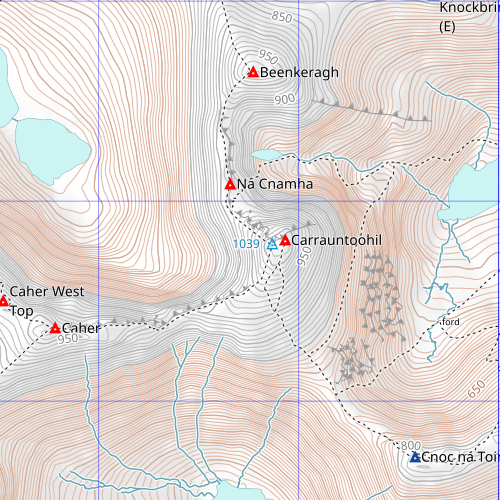
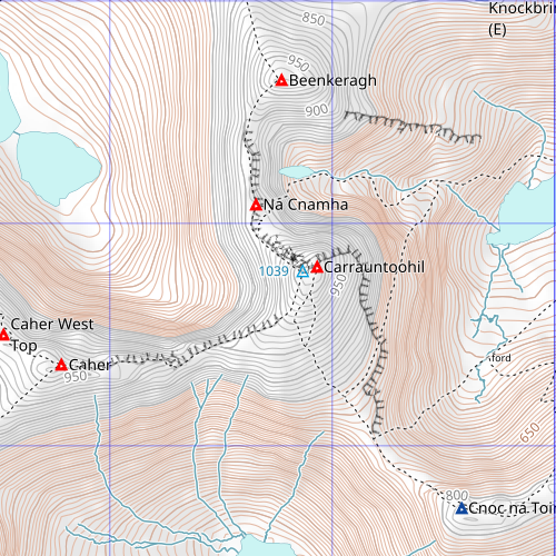
This release also includes some work to improved the "ornaments" - the black lines used to mark rocks and cliffs - in Ireland.
You can see most of these by moving the slider right to expose more of the old tiles of the area around Carrauntoohil, the highest mountain in Ireland.
We've also done some work to improve field boundaries so we now show those in a light grey and boundaries with a fence or wall in dark grey.
Here's an example of that, again from Ireland.

These boundaries come from OSM and whether they are mapped varies a lot by area but we thought it worth adding as, where available, they're a valuable resource when walk planning.
These tiles are live so if you're using our tile server you will be seeing the updated tiles now.
| « | » |